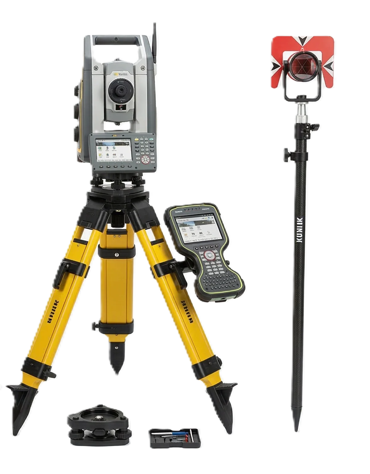
Total Station Survey Equipment
Designed for modern land surveyors, civil engineers, and construction professionals, this professional total station survey equipment combines an advanced electronic theodolite with a highly powerful electronic distance meter (EDM). Built to deliver exceptional precision in the most demanding field conditions, it is the ultimate surveying instrument for mapping complex topographies, laying out building foundations, or conducting routine boundary surveys. Ensure your field data is highly accurate, secure, and seamlessly integrated into your daily workflow.
Advanced Surveying Features:-
- Pinpoint Angular Accuracy: Features advanced dual-axis compensation to automatically correct tilt errors, ensuring reliable vertical and horizontal angle readings even on uneven or unstable terrain.
- Extended Reflectorless Measurement: Increase field safety and speed by measuring distances without a prism. The integrated EDM allows for reflectorless total station measurements up to 500 meters, ideal for hard-to-reach, elevated, or hazardous locations.
- Seamless CAD & Data Integration: Equipped with onboard data collection software, Bluetooth connectivity, and a standard USB port. Easily export your field data in industry-standard formats (DXF, CSV, TXT) directly to your data collector or drafting software.
- Rugged, Weatherproof Design: Built to withstand the harsh realities of active construction sites. With an IP66 dustproof and water-resistant rating, this surveying instrument performs flawlessly in extreme temperatures, heavy rain, and high-dust environments.
- Intuitive User Interface: The dual, high-contrast LCD screens and full alphanumeric keypad make navigating menus and inputting coordinate data fast and user-friendly, minimizing downtime and training for your surveying crew.
- All-Day Battery Life: Powered by two high-capacity, hot-swappable lithium-ion batteries. Get up to 14 hours of continuous operation so your team never has to halt a job due to a dead battery.
Ideal Industry Applications:-
- Land Surveying & Topography: Perfect for boundary surveys, subdivision layouts, and highly detailed topographic mapping.
- Construction Layout: Set out foundations, anchor bolts, and structural alignments with millimeter-level precision.
- Civil Engineering: Essential for roadway design, bridge construction, and accurate volume calculations for earthworks.
- Forensic & Scene Mapping: Provides precise spatial data collection for accident investigation and law enforcement applications.